Cadastral Maps and Their Usefulness
Reading maps can be confusing, with the invention of GPS, Google Maps etc, it is now rare to be travelling in a car as street signs flash by, the driver won’t slow down, and the map won’t unfold to where you want it. Maps are actually easy once you get the hang of it and in the library, there is no rush, you can master maps very quickly and they are a useful research tool.
A handy map to understand is the cadastral map. Many people want to know what their properties looked like originally. Was it surveyed as a quarter acre section or was it perhaps part of a one-acre grant to a militia man? Sometimes properties are not the same shape or have disappeared altogether. Some Hamilton city residential sections were originally farm properties given to militia officers. Until recently, they were not even within the city boundaries.
Land boundaries in a rapidly changing city often move about as subdivisions are undertaken and, not uncommon in Hamilton, as streets, especially arterial routes are created, re-routed and/or widened. An interesting spot to look at is the northern bit of the CBD. To track the changes, we can start with the earliest cadastral we have.
Cadastral is from a Greek word katastikhos, which translated to old Italian catastico and later, the French word cadastre; “register of the survey of lands”. So, the maps we have show the property boundaries and the later the map the more you see land parcels subdivided.
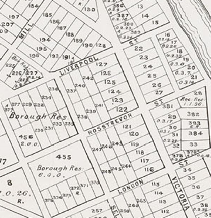
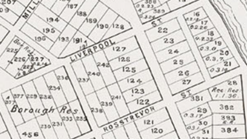
Let’s start with the 1895 map which shows much of the original survey of 1864. First note is that all the sections with no land values are one acre. Look at the block between Rosstrevor and London Streets bounded by Selkirk and Victoria Streets. It is twelve acres (4.8 hectares). The individual lots were all given to men of the militia. Now look at the 1927 map showing the same area:
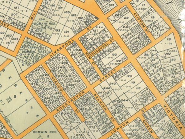
You can see that much subdividing has happened in the intervening thirty two years. Only five of the original twelve sections are still intact.
By 1927 some land has been lost to two streets, New Street & Choqueel Street now known as Harwood Street and Princes Street. With only one of the one acre blocks intact, this original twelve-acre block now has more than thirty individual sections.
You will also note, on both of these maps, each section or lot, has a number. It is not the street number (cadastral maps do not list street numbers) only the lot number, the deposited plan number (usually) and the land area. On the older maps the land area is in acres, roods & perches.
Call into Central Library, Level 3, if you would like to see the maps or search ‘Hamilton Map’ on our Heritage Collections Online to see them online.